Ormoc City (Ormoc City)
 |
Ormoc is an independent component city, not subject to regulation from the Provincial Government of Leyte. However, the city is part of the 4th Congressional District of Leyte together with Albuera, Kananga, Merida, Palompon and Isabel, and statistically grouped under the province by the Philippine Statistics Authority. On November 8, 2013, the city was extensively damaged by Super Typhoon Yolanda (Haiyan), having previously suffered severe destruction and loss of life in 1991 from torrential flooding during Tropical Storm Thelma (Uring).
The city's name is derived from ogmok, an archaic Visayan term for "lowland" or "depressed plain". The city also celebrates an annual thanksgiving festival called the Piña Festival in honor of the saints Peter and Paul in thanks for the bountiful pineapple harvest.
=== Early History === This place was used during the Spanish occupation and the migration of the neighboring towns to settle in the more fertile plains of Ormoc. Much of the settler in the town were the Malayans. These people had a constant trading with the Chinese, Javans and Indonesians. Their living, however, was always threatened by the attack of the Moro pirates. It is said that the people in Ormoc developed a warning system communication through people manning watch towers to inform and warn the people of the coming of these pirates.
Map - Ormoc City (Ormoc City)
Map
Country - Philippines
 |
 |
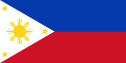
| Flag of the Philippines | |
Negritos, some of the archipelago's earliest inhabitants, were followed by successive waves of Austronesian peoples. Adoption of animism, Hinduism and Islam established island-kingdoms called Kedatuan, Rajahnates, and Sultanates. The arrival of Ferdinand Magellan, a Portuguese explorer leading a fleet for Spain, marked the beginning of Spanish colonization. In 1543, Spanish explorer Ruy López de Villalobos named the archipelago Las Islas Filipinas in honor of Philip II of Spain. Spanish settlement through Mexico, beginning in 1565, led to the Philippines becoming ruled by the Spanish Empire for more than 300 years. During this time, Catholicism became the dominant religion, and Manila became the western hub of trans-Pacific trade. In 1896, the Philippine Revolution began, which then became entwined with the 1898 Spanish–American War. Spain ceded the territory to the United States, while Filipino revolutionaries declared the First Philippine Republic. The ensuing Philippine–American War ended with the United States establishing control over the territory, which they maintained until the Japanese invasion of the islands during World War II. Following liberation, the Philippines became independent in 1946. Since then, the unitary sovereign state has often had a tumultuous experience with democracy, which included the overthrow of a decades-long dictatorship by a nonviolent revolution.
Currency / Language
| ISO | Currency | Symbol | Significant figures |
|---|---|---|---|
| PHP | Philippine peso | ₱ | 2 |
| ISO | Language |
|---|---|
| EN | English language |
| TL | Tagalog language |


